
While I was onboard a research cruise in 2017, worlds collided. My love of pop culture, science, and travel all met as we sailed past the Cliffs of Moher, or as Wallace Shawn as Vizzini would say, the Cliffs of Insanity. This wonder of the world, and frequent pit-stop on most people’s trips to Ireland, was 300 million years in the making and not only acted as a barrier for Wesley reaching Buttercup (The Princess Bride), but it’s also one of the places Voldemort hid one of his horcruxes (Harry Potter and the Half Blood Prince).
To witness how insane these cliffs of insanity really are, check out this video (also if you haven’t seen The Princess Bride yet, stop reading immediately, watch it, and then come back. You are welcome.).
The Cliffs of Moher are located on the west coast of Ireland in County Clare and are a world-renowned tourist site, with approximately one million tourists each year. The cliffs themselves were made over 300 million years ago during the Upper Carboniferous period. (Also check out this interactive map to visualize how Great Britain and Ireland were formed over time)
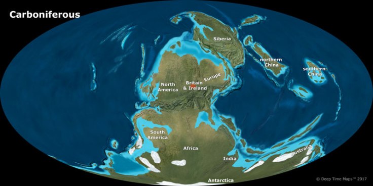
At this point Europe and North America were not separated by the Atlantic Ocean, and the area where the Cliffs of Moher currently stand was situated at the mouth of a large river. Sand, mud, and silt all collected at the end of this river as a result of heavy rains, ultimately forming a large river delta (think of the end of the Mississippi River now). Over millions of more years this sediment was eventually compacted into solid rock, creating layer upon layer of shale and sandstone. This “stacking” of mud and silt and sand also resulted in time capsules that can tell us about the history of the cliffs – from the type of sediment to the fossils found within each layer.
The Cliffs of Moher are known for their vast shear cliffs, which run for ~14 km and are ~155 m high, along with some unique geological formations along the bottom. Between the sandstone rock faces and the harsh waves, coastal erosion is responsible for both creating these unique and exquisite rock formations, and destroying them. Coastal erosion has created sea caves, sea stacks, and sea stumps. In fact, Banaunmore, a giant sea stack (67 m), was once connected to the cliffs but through coastal erosion it sits as a solitary sea stack in the ocean. These layers along the cliffside and coastal formations can be seen below in some of the pictures I took while exploring the Cliffs.


The waves that have helped to carve out the cliffs and create these unique rock formations have also helped the Cliffs of Moher to become a world famous surfing destination. Below the Cliffs, a shallow reef bed formed of sandstone and surrounded by deeper water causes a focussing of wave energy, resulting in a huge increase in wave height. This geographical formation plus the occassional storm swells, the swell of the tide, and a strong easterly offshore wind all combine to create this monster of a wave, named “Aileen’s” by the locals (Wild Atlantic Way; Hart et al.) Aileen’s, which can produce waves as high as 12 m, was first tackled (in a surfing sense) in 2005 by John McCarthy and since then has turned into a popular world-class surfing location. That being said, this wave is for the experts only; it’s even treaturous to get to – first hiking down the cliffs and then a 2-mile paddle or jet ski out. Check out the below video for some mesmerizing videos of these elite surfers conquering Aileen’s, coupled with some great Irish tunes.
Tourism has long been the bread-and-butter of the Cliffs of Moher. As early as the 16th century tourists, often young nobles travelling around Europe, were travelling to see the Cliffs. In the 19th century Cornelius O’Brien built a tower at the heighest point of the Cliffs. This tower is still standing (see my photo from 2017); in the 1970s the tower was restored and in 1978 the first visitor centre was built, ushering in the modern era of nature tourism.

In 2007, a redesigned Cliffs of Moher visitor centre was opened, an update to the small 1978 visitor centre that welcomed tourists until 2005. A paper by Healy et al. in 2016 looked at tourism at the Cliffs and the response of visitors to this newly designed, 45 million dollar, visitor centre. The older visitor centre, from 1978, was effectively a few small stone houses, fitting in with typical Irish countryside buildings. The new design however looks like something straight out of middle-earth. To reduce the visual impact (Healy et al. 2016), the new visitor centre was built almost entirely underground and looks like a lot of little hobbit holes poking out of the rolling hills. This unique TARDIS-like (it’s bigger on the inside) centre is filled with demonstrations and ammenities but (to me anyways) does not take away from the cliffs themselves. In Healy et al.’s 2016 paper they surveyed visitors to see how this more interactive, “edutainment-based” visitor centre was received by visitors. The authors did find some negativity associated with commercialism and excessive information for a nature display, ultimately suggesting that redesigns of interpretive centres should take into account the visitors’ opinions before any redesign happens. That being said I was very impressed by the vistor centre and enjoyed the breadth of information on the cliffs. To me the design built into the lansdcape was the perfect mix between a modern visitor centre, and one meant to highlight the natural beauty of a location.
So, whether you are Harry Potter looking for a horcrux, Fezzik climbing the cliffs, a world class surfer, or an average totally normal tourist, there is something for all to enjoy at the Cliffs of Moher.
References:
Healy, Noel, Carena J. Van Riper, and Stephen W. Boyd. “Low versus high intensity approaches to interpretive tourism planning: The case of the Cliffs of Moher, Ireland.” Tourism Management 52 (2016): 574-583.
https://www.wildatlanticway.com/highlights/aileens-wave
Hart, A., Joshi, S., Duffy, G., Guihen, D., and White, M. Understanding a “perfect” wave; a study of giant surf beneath the Cliffs of Moher. Undergraduate Poster http://www.nuigalway.ie/biogeoscience/documents/alex_poster_final_website.pdf
Map of the World during the Carboniferous period: https://www.bgs.ac.uk/discoveringGeology/climateChange/climateThroughTime/map.html
https://en.wikipedia.org/wiki/Cliffs_of_Moher
Click to access Cliffs-of-Moher-Geology.pdf
Click to access Cliffs-of-Moher-Geology.pdf

Leave a comment